Verify "correctness" by comparing 2D images with ENVI Freelook. This is a very limited, but free version of ENVI available for download. See http://www.rsinc.com/Envi/freelook.cfm [link outdated] or ftp://ftp.rsinc.com/pub/freelook/ [link outdated] for more information.
Develop code using the C programming language and use OpenGL for graphics. The C compiler was a free download from Microsoft, included with the .NET SDK (Software Development Kit).
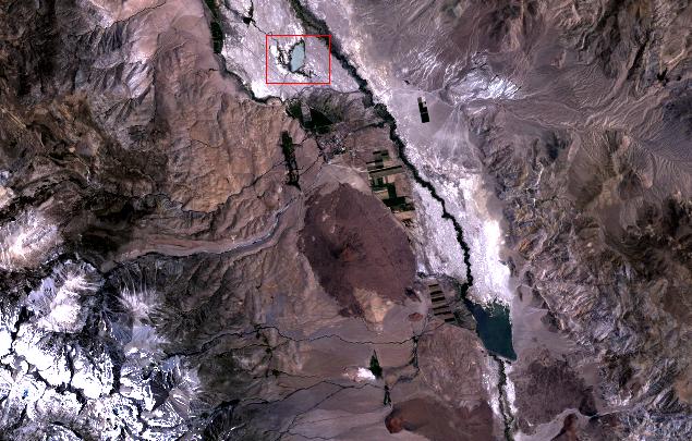
Landsat image (acquired 7/7/1984) as viewed from ENVI using a 3-2-1 band combination:
Description of Landsat image:
This Landsat image shows Owens Valley of eastern California. The town of Big Pine is located to the north of
Crater Mountain, the large brownish feature near the center of the image.
"The rugged crest of the Sierra Nevada Mountains flanks the valley on the southwest, and the Inyo Mountains
lie along the eastern edge.
This is a desert landscape with only sparse natural vegetation; some irrigated cropland is found near the Owens River.
The scene principally illustrates geologic features, such as the glacially-sculpted Sierra crest
(with partial snow cover) and broad alluvial fans stretching eastward from the mountain front.
Recent basalt lava flows and cinder cones (dark gray to red tones) cover parts of the down-faulted Owens valley.
The large cinder cone just south of Big Pine (Crater Mountain) is cut by two fault scarps visible as dark lines or
color changes. The western fault line stretches southward (marked on its upslope side by patches of
dark green vegetation) to the smaller cinder cone Red Mountain at the center of the scene." [1].
Landsat data is displayed with 2% linear stretch.
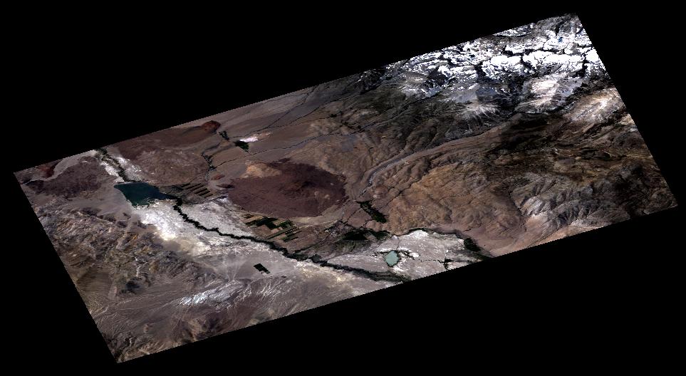
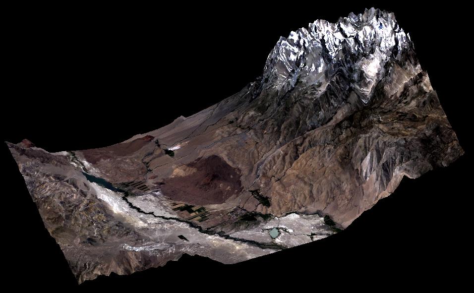
Ability to convert Landsat image to 3D using DEM data.
Ability to switch between 2D and 3D on-the-fly.
Ability to change Landsat band combinations on-the-fly.
Ability to change resolutions on-the-fly (decimation to speed up rendering).
Rotation, Translation, and Scaling (Zooming) of 2D and 3D images.
The program initially did not offer the 2% linear stretch and the images looked very poor.
It took me quite a while to code the stretch to produce images as nice as ENVI. I had to compute a histogram internally, shave off 2% on each end, and then "rescale" the remaining 96% of the data over the full 8-bit color range.
Big Pine: 2D Landsat 3-2-1 image
Big Pine: 3D DEM with Landsat 3-2-1 overlay
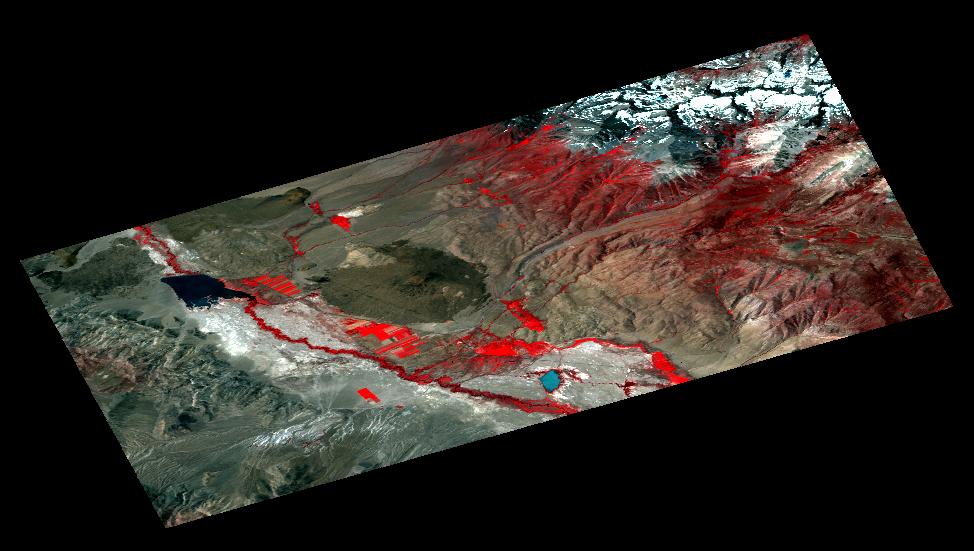
Big Pine: 2D Landsat 4-3-2 image
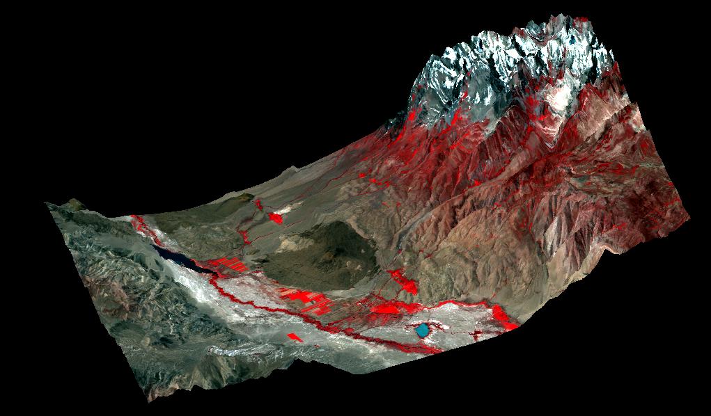
Big Pine: 3D DEM with Landsat 4-3-2 overlay
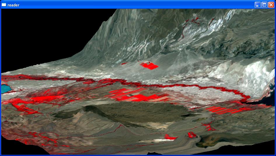
Big Pine: 3D DEM with Landsat 4-3-2, zoomed in
Here is a screenshot of 3D viewer someone else wrote of the same area [1].
My testing has been with the unwarped Landsat data from Lab 8, and it the program is hardwired to read in the 1278x819 pixels (big_pine.bsq).
Add support for mouse control of rotations, translations, and zooms.
Add support for lighting light defition and smooth shading to simulate sunshine.
Add control over vertical exaggeration.
Add support for band ratios.
Clean up the source code, and potentially convert to another language in order to allow the
3D models to be manipulated using the web. A logical choice for this might be to generate
models in VRML (virtual reality modeling language) and use a client-side browser for image
manipulating. An example VRML client can be downloaded from
Cortona, and example VRML
images can be obtained from the following sites once you have installed the Cortona plug-in:
3D Virtual Garden [link outdated]
3D Human Body
[2] Woo, Mason. OpenGL Programming Guide. Second Edition. 1997.